Visit the Sites
Visit the Sites
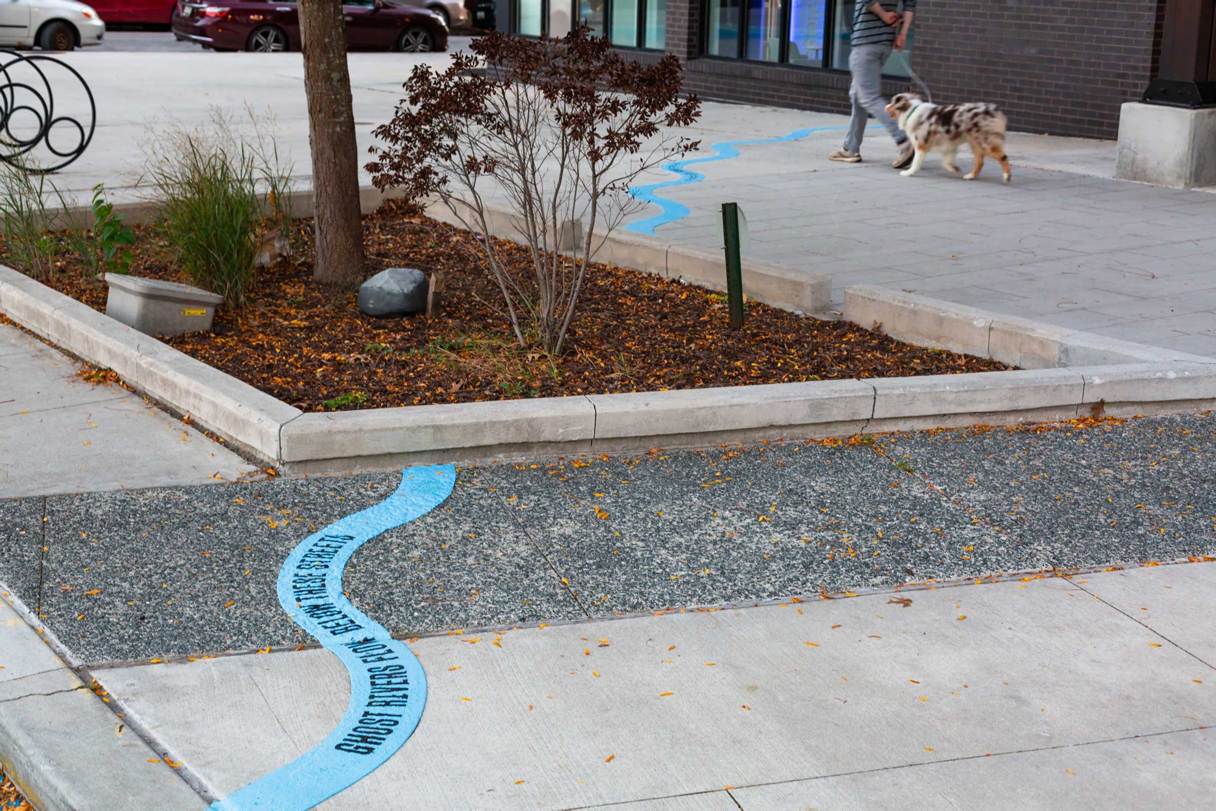
Take a self-guided walking tour of the Ghost Rivers project and follow the lost path of Sumwalt Run through Baltimore.

Exploring the sites
Sumwalt Run installation Sites 1–12 are now open. You can walk the sites as a self-guided tour.
Use this website as a virtual guide by scanning the QR code on each sign to wade deeper into each site/topic, or explore the project at home.
Ghost Rivers Installations Map
Open this map in your device’s Google Maps app to plot your visit and see the original path of Sumwalt Run overlaid on today’s street grid. Markers indicate the approximate locations of Ghost Rivers installations and signs.
Sumwalt Run and the Ghost Rivers project are located on the traditional and unceded lands of the Piscataway and Susquehannock peoples, in present-day Baltimore, Maryland.

Itineraries & Notes on Visiting
Ghost Rivers sites can be experienced in any order, but we recommend starting at Site 1 in Wyman Park Dell.
Sites 10 and 11 are located in lower Remington, and Site 12 is along the Jones Falls trail. Reaching these sites (Site 12 particular) requires a longer, more indirect walking route that crosses some busy roads and industrial areas. If anyone in your party is unable to walk longer distances, we recommend using transportation to visit these sites.
If you prefer a shorter walking itinerary, start at site 1 or 2 (at Wyman Park Dell) and follow the stream path through sites 7, 8, or 9.
To do the full walking tour, plan to spend at least 1 hour from start to finish, plus time to walk back. There are some great local restaurants and coffee shops near sites 5–7 if you’d like to break up your walk.
Maryland Avenue provides the safest, most direct return path to Wyman Park Dell from sites 10–12, and can be easily biked along the Maryland Avenue cycle track.
While visiting, please be respectful of the people who live and work in Remington. They’ve helped to make this experience possible!
